Breaking news
Belgian Air Component tests drone capabilities.
In Belgium, the Lombardsijde military district is an ideal site to test the capabilities of drones. Day and night, land and air component specialists work together to experiment with various scenarios on land and at sea.
Follow Air Recognition on Google News at this link
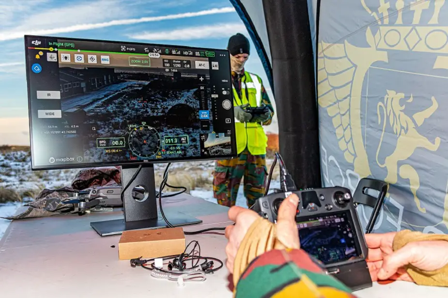
 Drones or unmanned devices have been used for many years within the Belgian Defense (Picture source: mil.be)
Drones are part of our daily life. Their use is increasing, both in the private sector and in the economic sector. However, it was in the field of military aviation that the drone was born in the late 1960s. Old devices were recycled unmanned and remotely controlled, and then used as aerial targets during exercises. The concept of the drone, the unmanned aerial vehicle (UAV) or the remotely piloted aircraft system (RPAS) was born.
Drones or unmanned devices have also been used for many years within the Belgian Defense. Just think of 14 Anti-Aircraft Artillery Regiment or 80 Unmanned Aerial Vehicle Squadron where drones were the unit's weapon system. Current technological advancements and developments in unmanned aviation have, once again, made the drone a potential weapon system for the future.
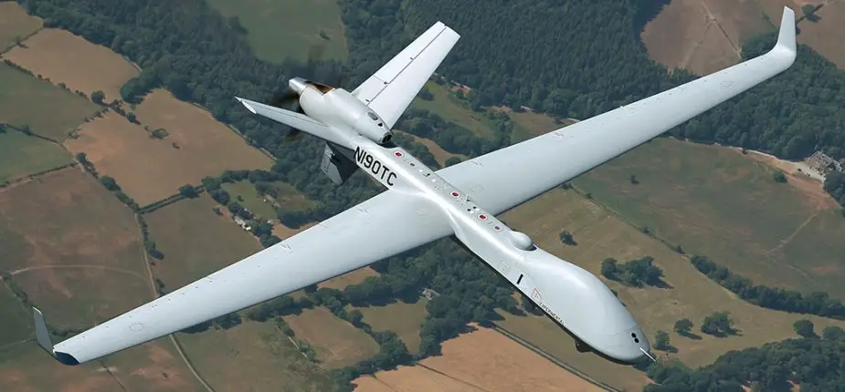
For example, the arrival of the MQ-9B Skyguardian is scheduled for 2023.
 MQ-9B Skyguardian (Picture source: GA-ASI)
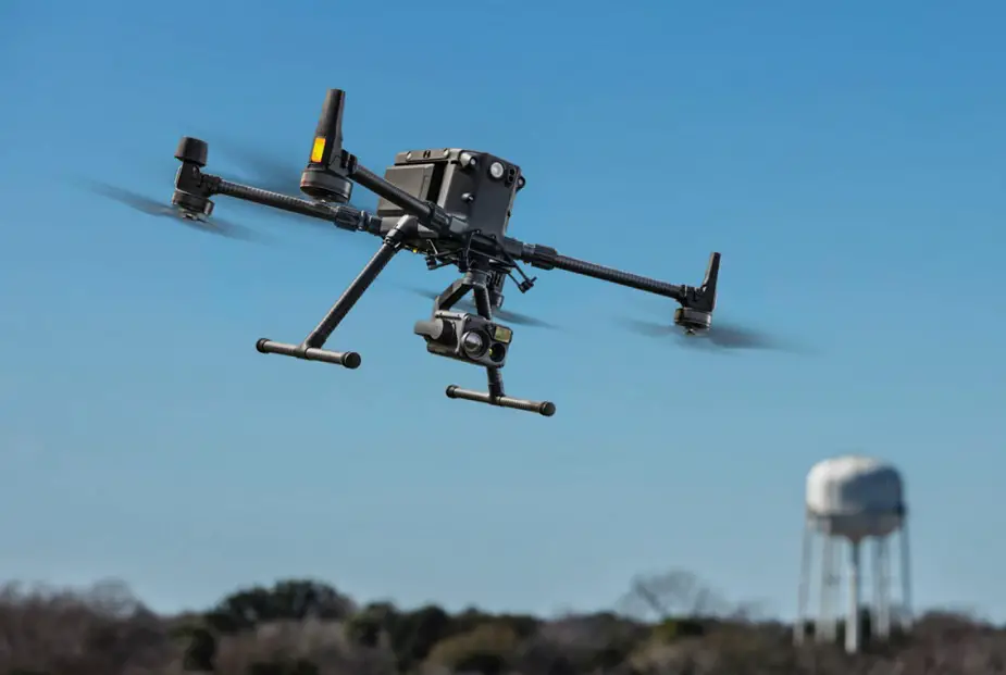
On a smaller scale, the Air Component is currently studying the possibility of integrating a DJI Matrice 300 type drone as an additional capacity in support of operations and missions. daily of our units. The idea of integrating the use of aerial images within our Air Component, in areas such as communication, assessment, infrastructure, aviation safety and base surveillance, was born in spring 2020 .
 Matrice 300 (Picture source: DJI)
“During a recent evaluation exercise organized at the Florennes air base, we noticed that mapping the unit's reactions to certain incidents would be of absolute added value in order to adapt procedures and manage problems in an even more more efficient, ”says Aviation Major Jeroen Mombers-Schepers by way of introduction. Jeroen, an industrial engineer in aeronautical mechanics by training, is part of the "Standardization, Ambition and Evaluation" (S.A.Eval) division within COMOPSAIR and works as the project officer responsible for the Proof of Concept of the drone project. Its objective is to make known the detailed expression of these needs in the near future.
After an internal investigation with the staff of our Air Component, it quickly became apparent that several divisions could use a drone like the one of the DJI Matrice 300 type in support of daily operations. Besides its use as a tool for assessments (for which we use the device), the Aviation Safety Directorate (ASD) felt that an RPAS could be an excellent tool for mapping the magnitude and impact of air accidents. aviation.
The same goes for our Force Protection units. The bases have many green spaces and several square kilometers. In the event of an unauthorized intrusion into a military zone, the operator can direct the security forces with his drone. The troop commander has a perfect overview of the area. During the night, by means of the tracking spot and the thermal camera that can be fitted to the drone, an intruder has no chance.
This capacity can also be used for infrastructure works. "During a cold morning in December 2020 and at the request of the infrastructure service of the Queen Elisabeth District in Evere, we detected a hot underground water leak through which more than 22m³ of hot water was lost every day" , Jeroen continues when mounting the thermal camera and tracking spotlight on the DJI M300.
“The military district of Lombardsijde, where we are currently located, is an ideal base for testing the capabilities of the drone and in particular the imaging of the cameras. The cooperation with our colleagues from the Earth Component is going perfectly and we are receiving maximum support. "
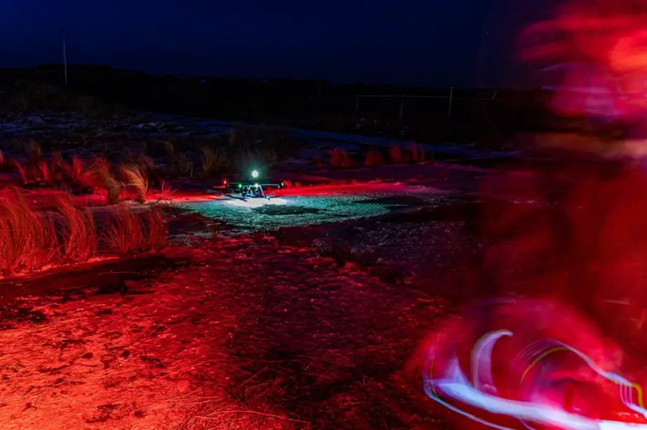
“We will be testing various scenarios in the dark and during the night. We will look for a boat above the sea that wants to enter our area for example. “Elsewhere, colleagues will hide in dunes and buildings. The goal will be to capture their body heat with the thermal camera and automatically follow their every move with the trackingsystem. Using the tracking spot and the GPS coordinates, we can then guide the Force Protection units to the right place, ”Jeroen explains as he directs the drone towards the sea.
“You fly this drone with a team. I just take care of the piloting. Control of the camera and the tracking spot is in the hands of a second operator. Analysis of live images, based on an external monitor connected to the system, requires a third party. The current system can provide significant added value in support of the daily tasks of our units, but finding the appropriate IT resources to store, process and transmit the images is still a major challenge ”, concludes Jeroen.
 “We will be testing various scenarios in the dark and during the night" said Aviation Major Jeroen Mombers-Schepers (Picture source: mil.be)


