Breaking news
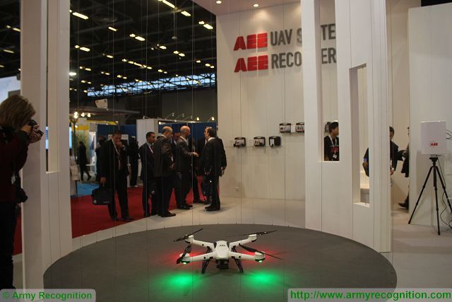
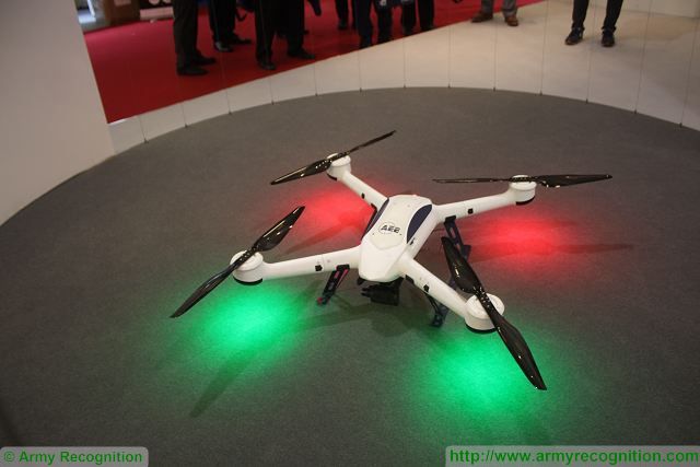
Chinese Company AEE presents latest technology of UAV with its F100 drone at Milipol 2015 11711152.
 |
|||
|
MILIPOL 2015 Show Daily News
Worldwide Exhibition of Internal State Security Web TV - Pictures Gallery 19 - 22 November 2015 Paris, France |
|||
|
AEE Aicraft Systems at Milipol 2015
|
|||
|
|
|||
|
|
|||
| Chinese Company AEE presents latest technology of UAV with its F100 drone at Milipol 2015. | |||
|
At Milipol Paris, the Chinese-based Company AEE Technology presents its full range of UAV for security and military applications using latest technology infrared and thermal imaging camera. Established in 1999, AEE is the pioneer professional R&D manufacturer specialized in development and application of the wireless AV transmission technology.
|
|||
|
|
|||
 AEE F100UAV at Worldwide Exhibition of Internal State Security in Paris, France. AEE F100UAV at Worldwide Exhibition of Internal State Security in Paris, France. |
|||
|
|
|||
|
AEE has integrated four drive rotor unmanned aircraft system F100, which is developed on the basis of modularity. Kvadrokopter can flexibly change the task board equipment to meet different needs. F100 Built - in professional vibration lock.
Kvadrokopter F100 can be equipped with a professional on-board equipment, on-board super low illumination, black and white camera, an onboard infrared camera for night shooting, board professional camera with 16 million pixels and airborne professional 3D- camera with uniaxial holder, with the possibility rotation 0-105 degrees up and down. Weight with battery is 6 kg. Kvadrokoptera design made of high molecular integrated ultra high-strength carbon fiber composite. Glider and holder that is fully made of ultra high molecular high-strength carbon fiber composite materials boast a high strength and light quality. With the ground station D02 the F100 UAV can be controlled up to a distance of 7 km, it offers the capacity to receive, display and store real-time video from the airborne camera, and control the camera's angle and zooming. The control station D02 is fitted with a 15" of high light screen. The D02 control station is able to set waypoints so that the UAV can perform auto-navigation mission and display the track of the UAV during fly. |
|||
|
|
|||
 |


