


Flyby, a company specialized in the development of Decision Support Systems, presents FlySight, its strategic business unit in Defecence and security along with its others solutions at DSEI Exhibition 2017, being held in London from 12-15 September.
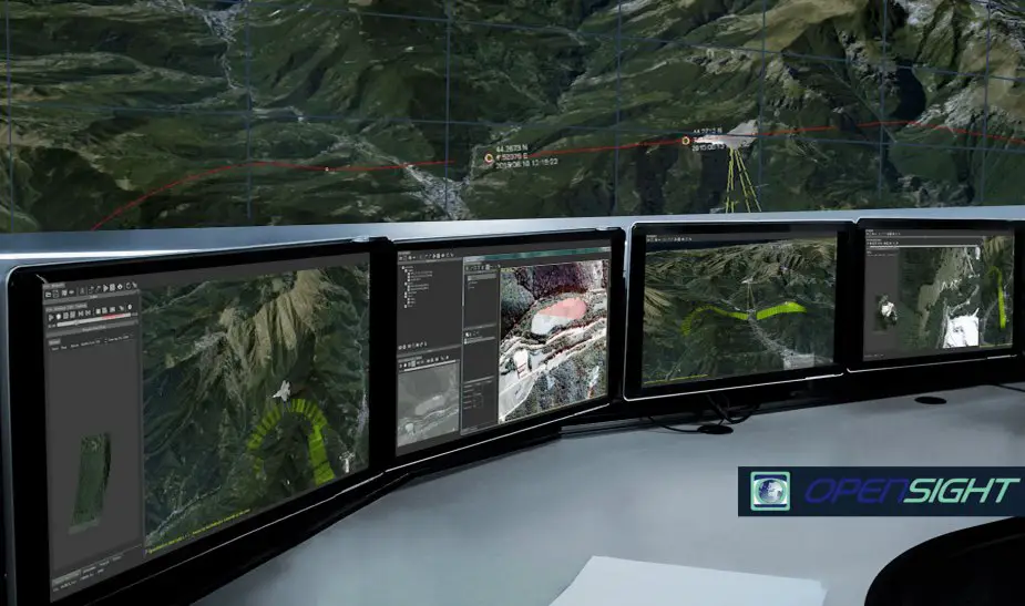
Flyby OpenSIGHT concept
(Credit: Flyby)
Flyby team is also showing OpenSIGHT performances with its plug-ins and a set of components that can be added into devices already adopted by means of several ready to use software tools to analyse, fuse and simulate any kind of geospatial data.
The new concept for PED (Processing Exploitation and Dissemination) is OpenSIGHT, a multiplatform PED system to support decision making for specific applications. It integrates a Geo-exploitation toolbox that represent a new environment concept for mission data analysis and visualization. OpenSIGHT is essential to get more awareness from any geospatial data type and get all intelligence solutions whose the mission needs.
OpenSIGHT key Features are:
- Platform independent (workstation, desktop or mobile, all operative systems)
- Modular plug-ins (each plug-in is exportable as a standalone application or library)
- Simultaneous GIS and 3D graphic rendering capabilities
- Real-time and archive mission data display and management
- Ease of customization and extension through a simple SDK.
OpenSIGHT has been developed following the STANAG guidelines and rules in more than 10 years of expertise matured in interfacing SW tools for the processing of airborne data sensors and avionics information.
OpenSIGHT proposes its performances in the following turn-key plugins suites solution:
- OpenSIGHT-GET: Geographic Exploitation Toolbox providing best real time GIS/ exploitation/ dissemination features for defence and security market.
- OpenSIGHT-MOSAIC: The solution answering specific post-processing needs for 3D reconstruction, mapping and measurement.
- OpenSIGHT-GDB: the solution enabling parallel/ distributed computing and geographic data-warehousing to support intelligence based on big data analysis.